Reaching New Heights!
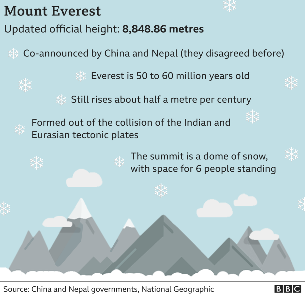
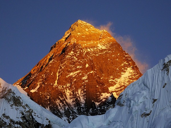
Until now the countries differed over whether to add the snow cap on top. The new height of Mount Everest is 8,848.86m (29,032 ft).
The following written content from Navin Singh Khadka
The world’s highest mountain Mount Everest is 0.86m higher than had been previously officially calculated, Nepal and China have jointly announced.
Until now the countries differed over whether to add the snow cap on top. The new height is 8,848.86m (29,032 ft).
China’s previous official measurement of 8,844.43m had put the mountain nearly four metres lower than Nepal’s.
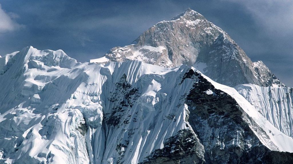
Everest stands on the border between China and Nepal and mountaineers climb it from both sides.
Officials at Nepal’s foreign ministry and department of survey said surveyors from both countries had co-ordinated to agree on the new height.
The agreement to jointly announce the new measurement of the Earth’s highest point was made during Chinese President Xi Jinping’s visit to the Nepalese capital, Kathmandu last year.
Why the difference over official height?
Chinese authorities had said previously Mount Everest should be measured to its rock height, while Nepalese authorities argued the snow on top of the summit should be included.
The Chinese surveyors had calculated their figure after they measured the mountain in 2005.
Nepal’s government officials told the BBC in 2012 that they were under pressure from China to accept the Chinese height and therefore they had decided to go for a fresh measurement to “set the record straight once and for all”.
The 8,848m height Nepal had been using for Mount Everest was determined by the Survey of India in 1954, but for the first time the country has now conducted its own measurement of the summit.
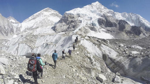
Four Nepalese land surveyors spent two years training for the mission, before heading to the summit.
“Before this, we had never done the measurement ourselves,” Damodar Dhakal, spokesman at Nepal’s department of survey, told the BBC.
“Now that we have a young, technical team [who could also go to the Everest summit], we could do it on our own,” Mr Dhakal said.
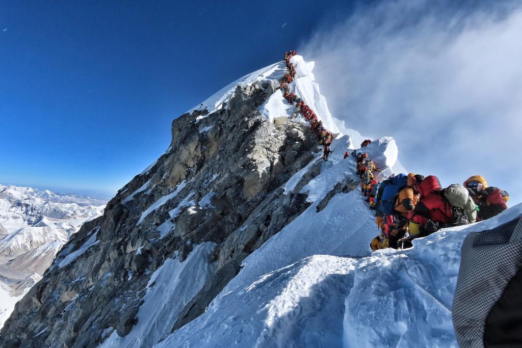
Nepal’s lead surveyor Khimlal Gautam lost his toe due to frostbite while on the summit to install height-measuring equipment last year.
“For summiteers, scaling the highest peak means a great accomplishment. For us, it was just the beginning,” Mr Gautam had told BBC Nepali after his return.
“Unlike other surveys of the Everest in the past, we chose 03:00 to minimise errors that could have been caused because of sunlight in the day time.”
Why else has the height been questioned?
Some geologists have suggested a major earthquake in 2015 may have had an impact on Mount Everest’s height. The 7.8 magnitude earthquake killed nearly 9,000 people in Nepal, and caused an avalanche which buried parts of the base camp at the mountain. At least 18 climbers were killed.
Some geologists said the earthquake may have caused Everest’s snow cap to shrink.
Scientists had found that some other Himalayan peaks such as Langtang Himal, mostly to the north of Kathmandu and close to the epicentre, had reduced in height by approximately a metre after the earthquake.
- Why the summit can get so crowded
- How deadly is Mount Everest?
- Ex-soldier breaks record for 14 highest mountains
- Seven things you didn’t know about Everest
Others have argued that Mount Everest, like other Himalayan peaks, may have actually grown over time because of the shifting tectonic plates it sits on. But experts say major earthquakes can result in that process being reversed.
“The 2015 earthquake is also a major reason why we re-measured the mountain,” said Mr Dhakal.
How was Mount Everest re-measured?
The heights of mountains are measured with the mean sea level as the base. So it’s less about working out the where the top is, than where the bottom would be.
Nepal used the Bay of Bengal as its sea level, but India had already surveyed a point closer to Everest, near the India-Nepal border, from the bay, and was able to provide the Nepalese surveyors with the height at that point.
From there, Nepal built a network of line-of-sight stations stretching nearly 250km (155 miles) to the point Everest first become visible, creating a chain of points it could measure and add together.
The Chinese surveyors, according to the state-run China Daily, used the Yellow Sea in the eastern province of Shandong as their sea-level base. Read more from BBC
Read similar news stories from News Without Politics
Subscribe to News Without Politics