Crossing the equator, the imaginary line that bisects the Earth, will change your view on global geography, weather patterns and aviation navigation.

The following written content via “Ask the Captain”, enRoute
I have crossed the equator more than 50 times, and I always look at the navigation computer displays as we count down to zero latitude. For me, flying over the hemispheric boundary is a navigational thrill that few people get to experience. It also means we can be swapping winter for summer: Australia can be basking in heat while it’s ‑40°C in Winnipeg, and a July flight to Chile can mean a reunion with ski season. And a bonus of flying in a north‑south direction is the lack of jet lag: A 10‑hour flight may stay within a single time zone, so your built‑in clock won’t miss a beat.
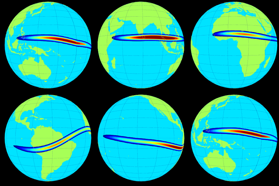
Weather fronts are rare near the equator – it’s just one hot and humid air mass. Tropical storms and hurricanes (typhoons) do not cross the line, and jet streams rarely do. But the equator does have its own unique weather phenomenon: the Intertropical Convergence Zone (ITCZ), a belt of thunderstorms undulating north and south, nourishing the rainforests of the Amazon, Congo and Indonesia. Since the troposphere (the layer of Earth’s atmosphere in which we live) is highest at the equator, these rainmakers can rise way up; weather radar helps us to fly around them. As a meteorologist, I can also rely on geosynchronous weather satellites parked 35,786 kilometres above the equator to guide me.
Way down at ground level as we cross the line, the widest part of the Earth is spinning on its axis at 1,670 kilometres an hour. That’s something to contemplate as you take in the view.
Equator Data
- Trade winds from the northern and southern hemispheres converge near the equator, forcing air up into the atmosphere where it forms clouds. This Intertropical Convergence Zone (ITCZ) shifts north and south with the sun, creating the tropics’ wet and dry seasons, the monsoons and other weather patterns.


