From News4Jax
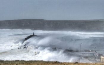
The most interesting turn in the slow-moving saga called Sally, is a notable shift in the forecast tracks to the east.
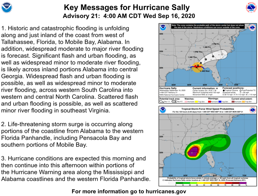
As of 5 a.m. Wednesday, the center of Hurricane Sally was impacting Gulf Shores, Ala.. Sally is moving toward the north at 2 mph. A slow northward motion is expected tonight, followed by a slow north-northeastward to northeastward motion Wednesday night. A slightly faster northeastward motion is expected on Thursday.
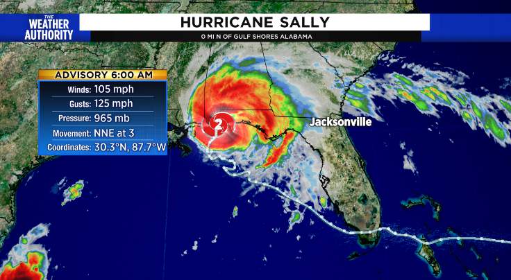
On the forecast track, the center of Sally will approach the northern Gulf Coast tonight, and make landfall in the hurricane warning area late tonight or Wednesday. Sally is expected to move inland across southeastern Alabama Wednesday night and Thursday.
TRACKING THE TROPICS:Interactive map
Below is from NOAA
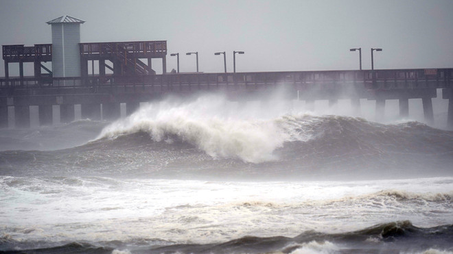
Data from a NOAA Hurricane Hunter aircraft and NWS Doppler radar indicates that maximum sustained winds are near 105 mph with higher gusts. Little change in strength is forecast until landfall occurs and Sally is expected to be a dangerous hurricane when it moves onshore along the north-central gulf coast.
Back to article
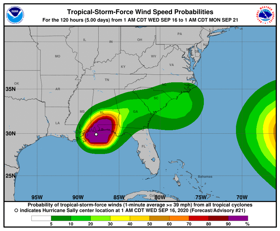
Hurricane-force winds extend outward up to 40 miles from the center and tropical-storm-force winds extend outward up to 125 miles. A NOAA buoy located about 50 miles southeast of Mobile, Alabama, recently reported sustained winds of 58 mph and a gust to 67 mph within the past couple of hours. An observing site at the Okaloosa Fishing Pier in Florida has reported sustained winds of 44 mph and a gust to 52 mph.
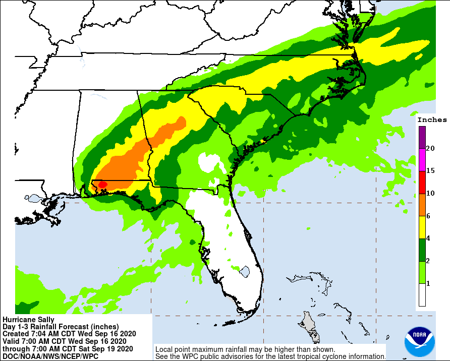
A Hurricane Warning has been issued from Grand Isle, Louisiana, northeast to Ocean Springs, Mississippi, including New Orleans, Lake Pontchartrain and Lake Maurepas. A Tropical Storm Warning has been issued from east of Ocean Springs, Mississippi, to Indian Pass, Florida.
A tropical storm watch was extended westward from the Okaloosa/Walton County line in Florida to the Alabama-Florida line.
A storm surge watch, meanwhile, was in effect from the mouth of the Mississippi River to the Alabama-Florida line, including Lake Pontchartrain, Lake Maurepas, Lake Borgne in Louisiana — and Mobile Bay in Alabama. Read more from News 4 Jax
Read other weather related stories from News Without Politics