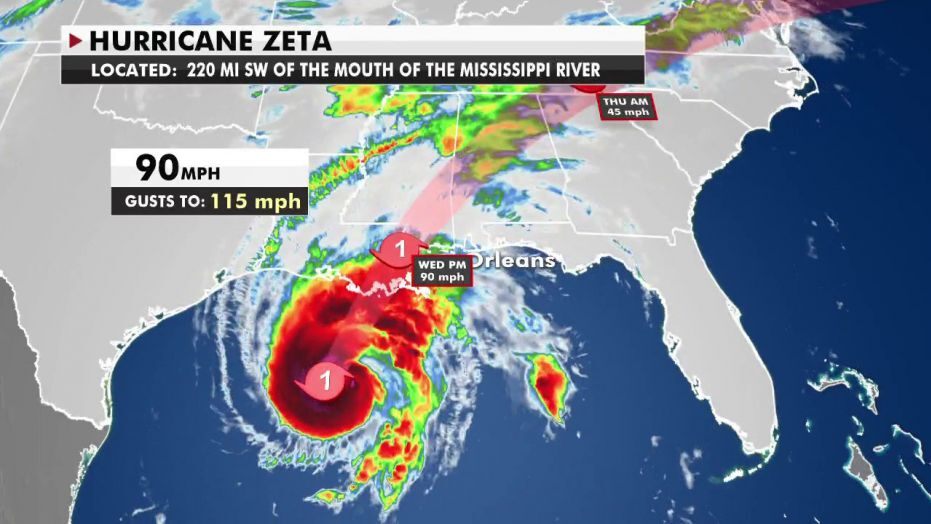
Hurricane Zeta has strengthened as it nears landfall on the Louisiana coast, where it’s expected to bring life-threatening storm surge, damaging winds and heavy rainfall.
Written content from Weather live video from and some written content from WWLTV
Damaging wind gusts will persist far inland across portions of the South, and widespread rainfall will also affect a wide area of the East through late week as Zeta interacts with another weather system.
Zeta regained hurricane strength Wednesday morning and is now centered over 200 miles south-southwest of New Orleans.
Conditions are beginning to deteriorate on the northern Gulf Coast as Zeta approaches.
A hurricane warning extends from Morgan City, Louisiana, to the Mississippi/Alabama border, including Lake Pontchartrain, Lake Maurepas and metropolitan New Orleans. Hurricane conditions (winds 74 mph or greater) are expected to arrive in parts of the hurricane warning area Wednesday afternoon into Wednesday night.
The storm surge warning includes areas from Intracoastal City, Louisiana, to Navarre, Florida, including Lake Borgne, Lake Pontchartrain, Vermilion Bay, Pensacola Bay and Mobile Bay. This means a life-threatening water rise from storm surge is possible in this area on Wednesday.
A tropical storm warning is also in effect for portions of southern Mississippi, Alabama, the western Florida panhandle and northern Georgia.
There is a tropical storm watch now posted as far north and east as western North Carolina and upstate South Carolina. Read more from Weather
The following written content is from WWLTV
Hurricane Zeta has increased in strength and forward speed and is now expected to impact southeast Louisiana around 3-4pm with category-2 strength winds of up to 100 mph. WWL-TV in New Orleans is providing live coverage all day long as the storm approaches, hits and departs the area. The main concern in the metro area is high winds which could down trees, send objects flying and causing power outages. This will be the fifth named storm to strike Louisiana this hurricane season. A record in recorded history. LIVE: Latest paths, models and radar for Hurricane Zeta: Read and see more from WWLTV
Read other severe weather stories from News Without Politics
Subscribe to News Without Politics
