Storm surge, damaging winds and inland flooding are the main threats
By Jason Samenow and Andrew Freedman for The Washington Post
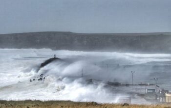
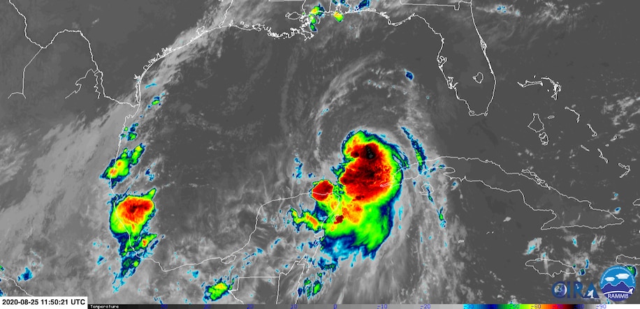
A serious hurricane situation is unfolding for the Gulf Coast as Hurricane Laura barrels toward the shores of Texas and Louisiana, intensifying as it traverses unusually warm waters.
The strengthening storm is predicted to make landfall late Wednesday or early Thursday at major Category 3 intensity.
The storm’s exact track is still coming into focus, with areas from Houston and Galveston, north into the Beaumont-Port Arthur region potentially seeing severe impacts, along with areas farther northeast, such as Lake Charles.
On Tuesday morning, the National Hurricane Center upgraded hurricane watches to warnings, and cover Galveston, coastal Houston, Port Arthur, Tex., and Lake Charles, La. Areas far from Hurricane Laura’s core will be affected by strong winds and heavy rain.
Passing over abnormally warm waters in the Gulf of Mexico, Laura is forecast to undergo bursts of intensification until it approaches land.
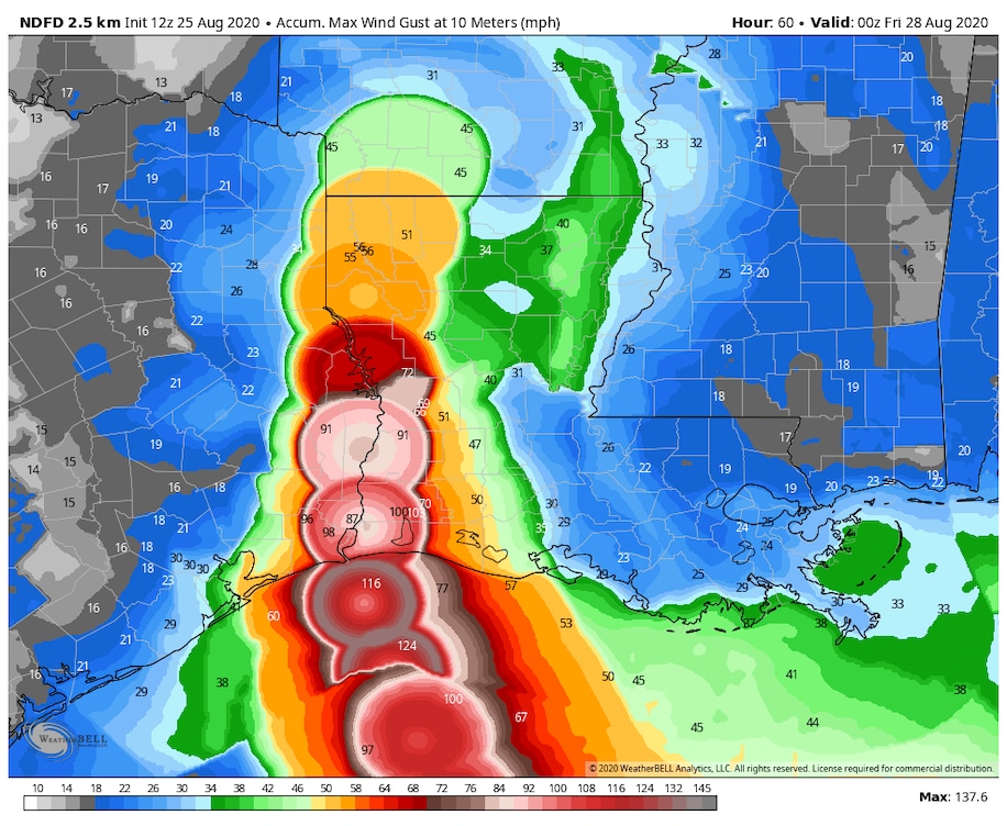
The National Hurricane Center is forecasting a “life-threatening” surge or storm-driven rise in water above normally dry land at the coast. Laura is also likely to unleash a narrow swath of destructive wind gusts over 100 mph near where it makes landfall.
Heavy rain is predicted to be widespread across the west-central Gulf Coast near the Texas and Louisiana border, with 4 to 8 inches falling over a broad area, and locally up to a foot, leading to areas of flash flooding.
Laura: Tracking map and times of arrival
The latest developments
- Hurricane watches were upgraded to warnings and cover San Luis Pass, Tex., just south of Galveston, to Intracoastal City in southwest Louisiana.
- Storm surge watches were upgraded to warnings and span from San Luis Pass to the mouth of the Mississippi River. The peak surge forecast was increased from 7 to 11 feet to 9 to 13 feet.
- The storm currently has maximum sustained winds of 75 mph, making it a Category 1 hurricane.
Read more from The Washington Post.
Follow “News Without Politics” for updates on the hurricane, severe weather and more U.S. News.
Stay informed: newswithoutpolitics.com