By The Visual and Data Journalism Team BBC News
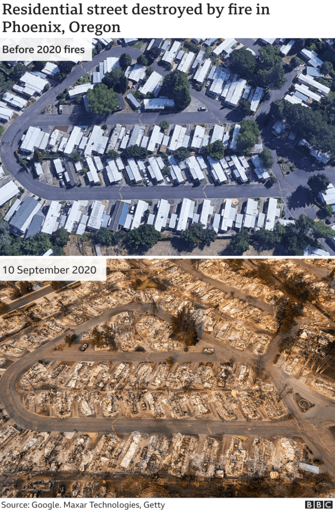
Dozens of wildfires have been burning their way through swathes of the US West Coast over the last month, killing more than 30 people and forcing tens of thousands from their homes.
Lightning strikes in August sparked a number of the blazes, while warm temperatures and dry conditions have fuelled additional fires.
Here’s a visual guide to what’s happening – a month on from a state of emergency being declared in California.
The fires are record-breaking
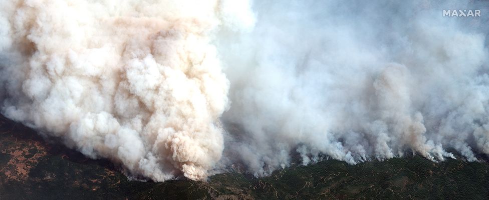
Wildfires are burning millions of acres in California, Oregon and other parts of the western US, devastating towns and blanketing communities in thick smoke.
Scientists say the region’s wildfires are the worst in 18 years and have linked their increasing prevalence and intensity to climate change. However, US President Donald Trump has blamed poor forest management for the blazes.
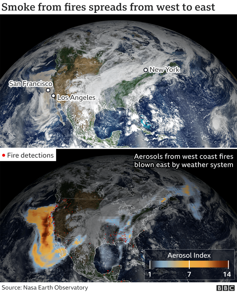
Plumes of smoke from the fires are so large, they have crossed the US and the Atlantic Ocean, carried by the jet stream, and have reached the skies of Europe.
Nasa captured the high-altitude smoke and associated aerosols – particles in the air – as they travelled east to New York City and Washington DC in the middle of last week.
By the end of last week the smoke had reached Northern Europe, scientists from the European Commission’s Copernicus Atmosphere Monitoring Service (CAMS) say. It is forecast to do so again in the coming days.
The fact the fires are emitting so much pollution that can be detected thousands of miles away reflects “just how devastating they have been in their magnitude and duration”, says Mark Parrington, a CAMS senior scientist.
Data from CAMS also shows the fires are “significantly more intense” than the average for 2003-2019 and are the worst in 18 years.
Nasa has described a “perfect storm of meteorological factors” contributing to the period of “extreme burning”. Record-breaking temperatures, unusually dry air and fierce winds – on top of drought in some areas – have exacerbated the fires.
Vincent Ambrosia, from Nasa’s Earth Applied Sciences Program’s wildfire research team, said these conditions, alongside the “long-term drying and warming of both the air and vegetation”, meant larger, higher-intensity fires.
Some have estimated the economic impact of this year’s fires could be more than $20bn (£15.5bn).
More on the fires:
- How we outran a California wildfire
- What are the health risks of smoke pollution?
- Climate change takes centre stage amid wildfires

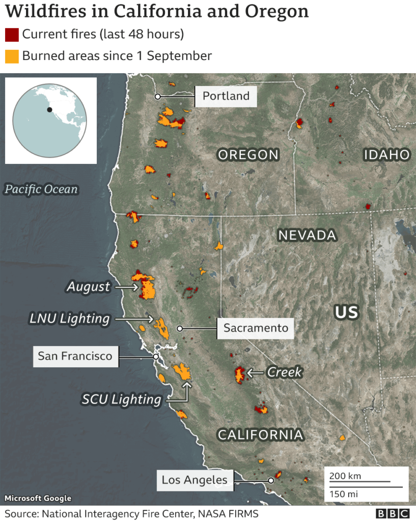
The wildfires are devastating California and Oregon
The US National Interagency Fire Center has said firefighters are battling 106 large wildfires across the western US, with higher-than-normal levels of burning in a number of states.
California and Oregon have seen some of the worst of the blazes. Read more from BBC
Read other similar stories from News Without Politics