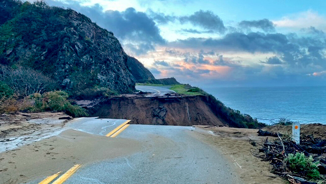
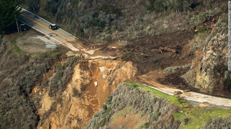
An enormous chunk of Highway 1 near Big Sur California collapsed into the Pacific after a significant drenching winter storm
The following written content from Jesse O’Neill
California transportation officials release jaw-dropping drone footage of the aftermath of the states’ scenic coastal highway collapse.
The startling aerial footage shows the massive chunk of the famous Pacific Coast Highway swallowed up by a deep crevice in the cliffs bluffing the Pacific Ocean. The birds-eye view reveals how huge sections of both the north and southbound lanes crumbled into the sea amid torrential rain storms Friday.
“Check out this amazing drone video of #Hwy1 washout at Rat Creek about 15 miles south of #BigSur. Our crews are on site securing it, assessing damage & starting clean-up/ repairs,” the California Department of Transportation tweeted Sunday.
Officials are still appraising the damage and could not give a timetable for completion of the enormous undertaking needed to repair the central section of California Highway 1.
The highway, which stretches for 656 miles along the Golden State’s coast is closed for miles in both directions of the disaster. Read more from NY Post