
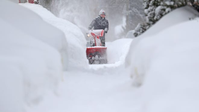
Bitter Cold, power millions of Texans still without electricity as a significant winter storm will impact the southeast today
A major winter storm will impact the Southeast U.S. today bringing with it significant icing and heavy snowfall.
This system will track into the Ohio Valley, Mid-Atlantic, and Northeast U.S. Thursday into Friday, producing similar impacts. Temperatures will still remain 20 to 35 degrees below normal throughout the Plains, Mississippi Valley, and lower Great Lakes.

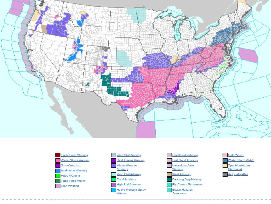
Over 100 million Americans are under Winter Storm Warnings, Winter Storm Watches, or Winter Weather Advisories as another round of impactful winter weather tracks from the Southern Plains to the East Coast… ..
.Developing winter storm to produce heavy snow and treacherous ice accumulations from the South Central U.S. to Mid-Atlantic… …Arctic air-mass to begin loosening its grip over the Heartland, but more bitterly cold temperatures expected to continue.
Showers and thunderstorms to track across the Southeast; Pacific storm system ushers in valley/coastal rain and heavy mountain snow to the Northwest…
A potent upper level trough tracking into the Southern Plains is responsible for areas of snow and freezing rain enveloping much of the South Central U.S. this morning. As the trough advances east, so will the shield of snowfall as it extends from Arkansas and the Mid-South to the central Appalachians with accumulations of 3 to 6 inches likely.
Heavier amounts over 8 inches are possible in parts of south-central Arkansas. Just south of the snow zone, significant ice accumulations are expected from east Texas and the Lower Mississippi Valley to the Virginia and North Carolina Piedmont by Wednesday night.
Ice accumulations of a quarter to a half inch are forecast in parts of east Texas, northern Louisiana, southern Arkansas, and western Mississippi with crippling totals over a half inch also possible. The same range of ice accumulations are anticipated in the North Carolina and Virginia Piedmont Wednesday night into Thursday with even some localized amounts as high as three-quarters of an inch.
In the areas that contend with these devastating ice accumulations, residents can expect dangerous travel conditions, numerous power outages, and extensive tree damage. Meanwhile, periods of moderate-to-heavy snow will breakout across the northern Mid-Atlantic Thursday with some locations switching over to sleet and/or freezing rain.
Heavy snow may work its way as far north as southern New England Thursday afternoon and persist into Thursday night. While snowfall totals are subject to how much sleet and freezing rain mixes in, the sheer amount of wintry precipitation will cause treacherous travel conditions and many travel delays.
The heaviest snow totals are likely to occur in the Appalachians of Virginia and West Virginia where as much as a foot is possible. The dangerous Arctic blast over the Nation’s Heartland begins to moderate in the coming days. While that means the number of record cold maximum and minimum temperatures will not be as common (the bulk of which occurring in the South Central U.S.), temperatures themselves will still remain 20 to 35 degrees below normal throughout the Plains, Mississippi Valley, and lower Great Lakes.
Morning lows in the single digits or below zero look to continue both today and Thursday in parts of the Great Plains. Bitterly cold temperatures have pushed east into the Mid-Atlantic and Northeast ahead of the impending winter storm that arrives Thursday morning.
High temperatures will struggle to eclipse the freezing mark both today and Thursday in these regions. The warmest location in the country is the state of Florida where highs look to soar into the 80s on Thursday.