
Image of Hurricane Ida from one million miles away in space and a little closer.
The following written content from space
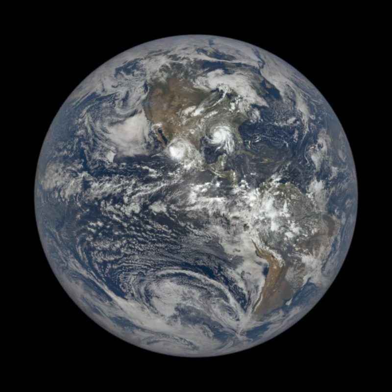
The massive Hurricane Ida is easily visible on Earth from 1 million miles away as seen by NOAA’s Deep Space Climate Observatory in orbit at a stable Lagrange point on Aug. 29, 2021 as the storm made landfall in Louisiana as a Category 4 storm.
Ida made landfall near Port Fourchon, Louisiana as a terrifying Category 4 hurricane, slamming into the state 16 years to the day of the devastating Hurricane Katrina in 2005. The storm knocked out power to thousands across the state and was expected to cause flooding from storm surge and torrential rain, as well as wind damage.
And closer
Two NASA centers, the Michoud Assembly Facility in New Orleans and Stennis Space Center in Mississippi were placed on emergency lockdown during the storm, with only essential personnel on hand to ride out the hurricane. Read more from Space
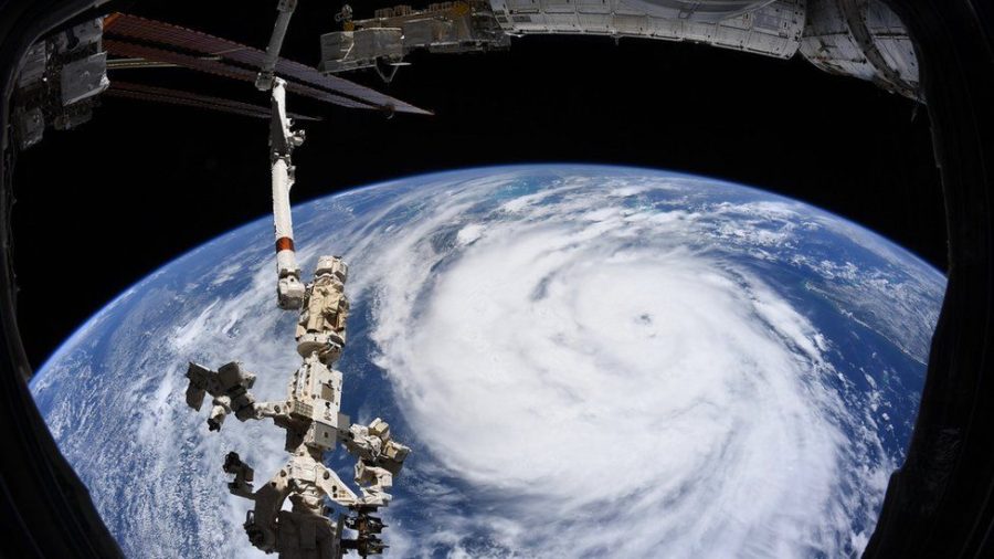
And closer still
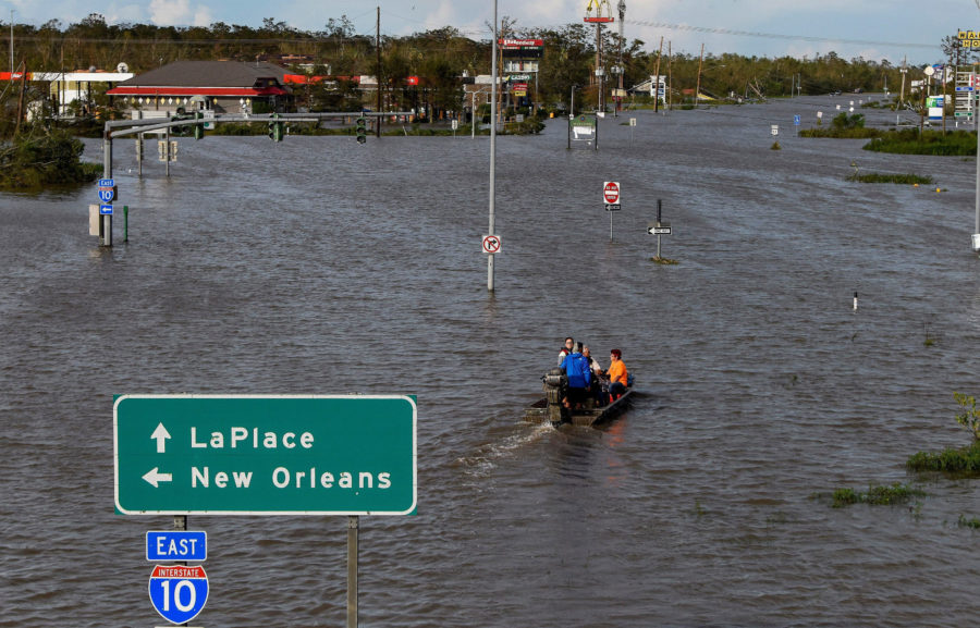
About a million customers were left without power as a slow-moving storm pummeled the region, causing at least two deaths.
Ida has now become a Category 1 hurricane in the Caribbean Sea and is forecast to hammer the northern U.S. Gulf Coast as a major hurricane this weekend with life-threatening storm surge, dangerous rainfall flooding, potentially devastating winds and tornadoes.
Winds have ticked up to 75 mph according to Hurricane Hunters currently flying around inside Ida, making the storm a hurricane. This increase means that Ida is already rapidly intensifying since winds increased from 30 mph Thursday afternoon to 75 mph Friday afternoon, an increase of 35 mph in less than 24 hours.. Read more from NWP